Geolocate

Mount Babel topographic map

Click on the map to display elevation.

About this map

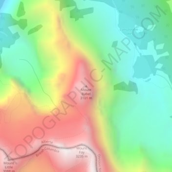
Name: Mount Babel topographic map, elevation, terrain.

Location: Mount Babel, Improvement District No. 9, Alberta, Canada (51.30669 -116.16349 51.30679 -116.16339)

Average elevation: 7,920 ft

Minimum elevation: 6,093 ft

Maximum elevation: 10,453 ft

Other topographic maps

Click on a map to view its topography, its elevation and its terrain.

Sawback Lake

Canada > Alberta > Improvement District No. 9

Average elevation: 7,343 ft

Luellen Lake

Canada > Alberta > Improvement District No. 9

Average elevation: 7,274 ft

Lake Agnes

Canada > Alberta > Improvement District No. 9

Average elevation: 7,080 ft

Peyto Lake

Canada > Alberta > Improvement District No. 9

Average elevation: 6,549 ft

Gear up for your next adventure:

🪶Trail Camera - Capture wildlife on your hikes
🧭Outdoor Navigation Book - Learn advanced navigation skills
🚪Portable Camp Chair - Foldable chair for comfort at camp
🧭Map Reading Tools - Tools and kits for map navigation
🌲Outdoor Survival Books - Best books on survival skills

As an Amazon Associate, this site earns from qualifying purchases at no extra cost to you.