Geolocate

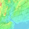
Murray topographic map

Click on the map to display elevation.

About this map

Name: Murray topographic map, elevation, terrain.

Location: Murray, Quinte West, Central Ontario, Ontario, Canada (43.99286 -77.75319 44.26391 -77.56946)

Average elevation: 407 ft

Minimum elevation: 230 ft

Maximum elevation: 860 ft

Other topographic maps

Click on a map to view its topography, its elevation and its terrain.
Quinte West

Canada > Ontario > Quinte West

Average elevation: 361 ft

Trenton

Canada > Ontario > Quinte West

Average elevation: 292 ft

Batawa

Canada > Ontario > Quinte West

Average elevation: 377 ft

Wooler

Canada > Ontario > Quinte West

Average elevation: 476 ft

Wooler

Canada > Ontario > Quinte West

Average elevation: 476 ft

Wooler

Canada > Ontario > Quinte West

Average elevation: 476 ft

Batawa

Canada > Ontario > Quinte West

Average elevation: 377 ft

Gear up for your next adventure:

🛡️Insect Repellent - Protection against bugs during outdoor activities
📻Weather Alert Radios - Stay informed of storm risks while off-the-grid
🧤Hiking Gloves - Protective gloves for rugged trails
📱Heavy-Duty Phone Cases - Drop-proof and waterproof protection for outdoor navigation
🔭Compact Binoculars - HD vision for scouting terrain and identifying distant landmarks

As an Amazon Associate, this site earns from qualifying purchases at no extra cost to you.