Geolocate

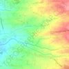
Laguile topographic map

Click on the map to display elevation.

About this map

Name: Laguile topographic map, elevation, terrain.

Location: Laguile, Taal, Batangas, Calabarzon, 4208, Philippines (13.88333 120.89987 13.92333 120.93987)

Average elevation: 125 ft

Minimum elevation: 0 ft

Maximum elevation: 361 ft

Other topographic maps

Click on a map to view its topography, its elevation and its terrain.

Bolbok

Philippines > Batangas > Taal

Average elevation: 384 ft

Pansol

Philippines > Batangas > Taal

Average elevation: 226 ft

Gear up for your next adventure:

🪶Survival Guide Book - Expert advice for emergency preparedness
🧭Map Reading Tools - Tools and kits for map navigation
🧣Hiking Neck Gaiter - Multi‑use neck protection for outdoor weather
🧯Portable Fire Pit - Compact fire pit for camping spots
🧥Men's Rain Shells - Premium waterproof and breathable jackets for mountain weather

As an Amazon Associate, this site earns from qualifying purchases at no extra cost to you.