Geolocate

Mulmur topographic map

Click on the map to display elevation.

About this map

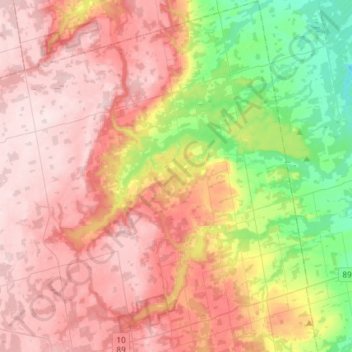
Name: Mulmur topographic map, elevation, terrain.

Location: Mulmur, Dufferin County, Central Ontario, Ontario, Canada (44.08425 -80.21214 44.29490 -79.99249)

Average elevation: 1,266 ft

Minimum elevation: 669 ft

Maximum elevation: 1,742 ft

Other topographic maps

Click on a map to view its topography, its elevation and its terrain.

Mono Cliffs Provincial Park

Canada > Ontario > Dufferin County > Mono

Average elevation: 1,519 ft

Honeywood

Canada > Ontario > Dufferin County > Mulmur

Average elevation: 1,657 ft

Mansfield

Canada > Ontario > Dufferin County > Mulmur

Average elevation: 1,043 ft

Primrose

Canada > Ontario > Dufferin County > Mulmur

Average elevation: 1,526 ft

Honeywood

Canada > Ontario > Dufferin County > Mulmur

Average elevation: 1,657 ft

Gear up for your next adventure:

🧺Microfiber Travel Towels - Compact and fast-drying towels for trail use
🛶Inflatable Kayak - Portable kayak for rivers, lakes, and expeditions
🏥Hiking First Aid Kits - Comprehensive medical kits for remote trail injuries
🪶Fire Starter Kit - Reliable fire starter for survival and camping
🦶Carbon Trekking Poles - Reduce knee impact on steep descents with ultra-light poles

As an Amazon Associate, this site earns from qualifying purchases at no extra cost to you.