Geolocate

Leadville topographic map

Click on the map to display elevation.

About this map

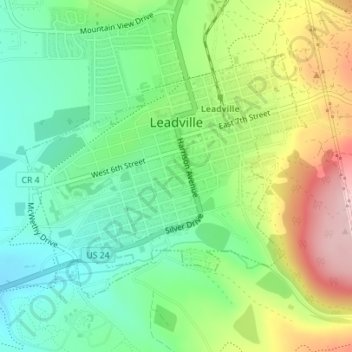
Name: Leadville topographic map, elevation, terrain.

Location: Leadville, Lake County, Colorado, 80461, United States (39.23730 -106.30754 39.25598 -106.27958)

Average elevation: 10,190 ft

Minimum elevation: 9,918 ft

Maximum elevation: 10,653 ft

Lake County trails, hiking, mountain biking, running and outdoor activities

Other topographic maps

Click on a map to view its topography, its elevation and its terrain.

Lake Creek

United States > Colorado > Lake County

Average elevation: 10,804 ft

Mount Evans

United States > Colorado > Lake County

Average elevation: 12,559 ft

Gear up for your next adventure:

🧣Hiking Neck Gaiter - Multi‑use neck protection for outdoor weather
🧭Map Reading Tools - Tools and kits for map navigation
🧢Outdoor Hiking Hat - Sun protection hat for outdoor explorers
🛡️Bear Spray Outdoor - Protection in bear country hikes
🚁Photography Drones - Capture stunning aerial views of landforms and topography

As an Amazon Associate, this site earns from qualifying purchases at no extra cost to you.