
Lauderdale Lakes topographic map
Interactive map
Click on the map to display elevation.
About this map
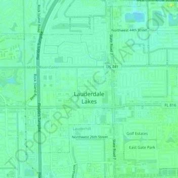
Name: Lauderdale Lakes topographic map, elevation, terrain.
Location: Lauderdale Lakes, Broward County, Florida, United States (26.15059 -80.21997 26.18621 -80.18292)
Average elevation: 20 ft
Minimum elevation: 0 ft
Maximum elevation: 39 ft
Broward County trails, hiking, mountain biking, running and outdoor activities
Other topographic maps
Click on a map to view its topography, its elevation and its terrain.
Bonita Bay
United States > Florida > Broward County > Fort Lauderdale > Soroka Shores
Average elevation: 13 ft
Cypress Isles Estates
United States > Florida > Broward County > Pompano Beach
Average elevation: 20 ft
Lauderdale Harbors
United States > Florida > Broward County > Fort Lauderdale
Average elevation: 20 ft
Bonita Bay
United States > Florida > Broward County > Fort Lauderdale > Soroka Shores
Average elevation: 13 ft
Fort Lauderdale Beach
United States > Florida > Broward County > Fort Lauderdale > Birch Ocean Front
Average elevation: 10 ft