Geolocate

Harbor View topographic map

Click on the map to display elevation.

About this map

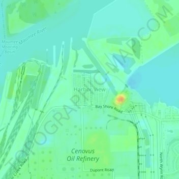
Name: Harbor View topographic map, elevation, terrain.

Location: Harbor View, Lucas County, Ohio, 43434, United States (41.69073 -83.44549 41.69589 -83.44402)

Average elevation: 584 ft

Minimum elevation: 554 ft

Maximum elevation: 656 ft

Lucas County trails, hiking, mountain biking, running and outdoor activities

Other topographic maps

Click on a map to view its topography, its elevation and its terrain.

Trilby

United States > Ohio > Lucas County > Toledo

Average elevation: 640 ft

Ironville

United States > Ohio > Lucas County > Toledo

Average elevation: 591 ft

Air Line Junction

United States > Ohio > Lucas County > Toledo

Average elevation: 623 ft

Garden

United States > Ohio > Lucas County

Average elevation: 669 ft

Gould

United States > Ohio > Lucas County > Toledo

Average elevation: 623 ft

Willow Beach

United States > Ohio > Lucas County > Toledo

Average elevation: 581 ft

Reynolds Corners

United States > Ohio > Lucas County > Toledo

Average elevation: 630 ft

Lakemont Landing

United States > Ohio > Lucas County

Average elevation: 568 ft

South Shore Park

United States > Ohio > Lucas County > Oregon

Average elevation: 577 ft

Willow Beach

United States > Ohio > Lucas County > Toledo

Average elevation: 581 ft

Monclova

United States > Ohio > Lucas County

Average elevation: 640 ft

Toledo

United States > Ohio > Lucas County > Toledo

Average elevation: 620 ft

Gear up for your next adventure:

⛑️Personal Locator Beacon - Safety beacon for emergencies
👟Trail Running Shoes - Lightweight shoes for trail runners
🌧️Backpack Rain Cover - Keep gear dry in wet weather
🏔️Mountain Trail Maps - High‑detail maps for popular peaks
🌐World Map Poster - Decorative world maps with topographic info

As an Amazon Associate, this site earns from qualifying purchases at no extra cost to you.