Geolocate

Monclova topographic map

Click on the map to display elevation.

About this map

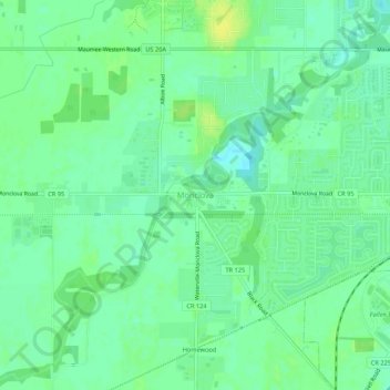
Name: Monclova topographic map, elevation, terrain.

Location: Monclova, Lucas County, Ohio, 43542, United States (41.53866 -83.75299 41.57866 -83.71299)

Average elevation: 640 ft

Minimum elevation: 614 ft

Maximum elevation: 669 ft

Lucas County trails, hiking, mountain biking, running and outdoor activities

Other topographic maps

Click on a map to view its topography, its elevation and its terrain.

Toledo

United States > Ohio > Lucas County

Average elevation: 614 ft

Toledo

United States > Ohio > Lucas County

Average elevation: 614 ft

Sylvania

United States > Ohio > Lucas County

Average elevation: 666 ft

Waterville

United States > Ohio > Lucas County

Average elevation: 646 ft

Harbor View

United States > Ohio > Lucas County

Average elevation: 584 ft

Maumee

United States > Ohio > Lucas County

Average elevation: 630 ft

Ottawa Park

United States > Ohio > Lucas County > Toledo

Average elevation: 620 ft

Toledo

United States > Ohio > Lucas County

Average elevation: 614 ft

Maumee

United States > Ohio > Lucas County

Average elevation: 630 ft

Ottawa Hills

United States > Ohio > Lucas County > Ottawa Hills

Average elevation: 630 ft

Gear up for your next adventure:

❄️Traction Cleats - Prevent slips on icy trails during winter hikes
🦶Carbon Trekking Poles - Reduce knee impact on steep descents with ultra-light poles
🗺️Topographic Maps - Detailed topo maps for hiking, exploring and outdoor navigation
🏫Relief Map Kits - Hands-on tools for teaching landforms and elevation
🎒Day Hiking Backpack - Lightweight backpack perfect for day trips and outdoor adventures

As an Amazon Associate, this site earns from qualifying purchases at no extra cost to you.