Geolocate

Podelwitz topographic map

Click on the map to display elevation.

About this map

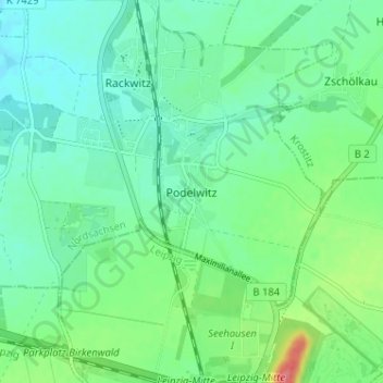
Name: Podelwitz topographic map, elevation, terrain.

Location: Podelwitz, Rackwitz, Nordsachsen, Saxony, 04519, Germany (51.40757 12.36218 51.44757 12.40218)

Average elevation: 413 ft

Minimum elevation: 354 ft

Maximum elevation: 577 ft

Other topographic maps

Click on a map to view its topography, its elevation and its terrain.

Elster-Saale-Kanal

Germany > Saxony > Nordsachsen > Schkeuditz

Average elevation: 364 ft

Elsnig

Germany > Saxony > Nordsachsen

Average elevation: 299 ft

04862

Germany > Saxony > Nordsachsen > Mockrehna

Average elevation: 351 ft

Torgau

Germany > Saxony > Nordsachsen

Average elevation: 302 ft

Bad Düben

Germany > Saxony > Nordsachsen

Average elevation: 322 ft

Naundorf

Germany > Saxony > Nordsachsen > Naundorf

Average elevation: 509 ft

Spielburg

Germany > Saxony > Nordsachsen > Eilenburg

Average elevation: 341 ft

Gear up for your next adventure:

🔥Plasma Lighters - Windproof lighters that work in any weather condition
🛏️Cold Weather Sleeping Bag - Warm sleeping bag for cold conditions
🪶LED Camping Lantern - Bright lantern for camp lighting
🪶Camp Gear Gift Set - Perfect gift bundle for outdoor fans
🔋Rechargeable Batteries - Power up your outdoor devices

As an Amazon Associate, this site earns from qualifying purchases at no extra cost to you.