
Make a donation
Gear up for your next adventure:
As an Amazon Associate, this site earns from qualifying purchases at no extra cost to you.
Colonia 96 topographic map
Click on the map to display elevation.
Make a donation
Gear up for your next adventure:
As an Amazon Associate, this site earns from qualifying purchases at no extra cost to you.
About this map
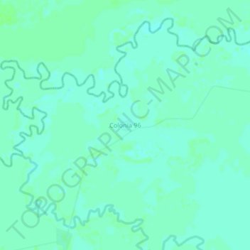
Name: Colonia 96 topographic map, elevation, terrain.
Location: Colonia 96, Presidente Hayes, Región Occidental, Paraguay (-23.23280 -57.90539 -23.19280 -57.86539)
Average elevation: 259 ft
Minimum elevation: 246 ft
Maximum elevation: 269 ft
Make a donation
Gear up for your next adventure:
As an Amazon Associate, this site earns from qualifying purchases at no extra cost to you.
Other topographic maps
Click on a map to view its topography, its elevation and its terrain.
José Falcón
Located in the Western region of Paraguay, in the area of Paraguayan Chaco. Its physical appearance is part of the characteristics of the Chaco soil: lowland with abundant vegetation of palm trees. It is a coastal city located at the junction between the Pilcomayo and Paraguay rivers. This district is located…
Average elevation: 243 ft
Make a donation
Gear up for your next adventure:
As an Amazon Associate, this site earns from qualifying purchases at no extra cost to you.