
Make a donation
Gear up for your next adventure:
As an Amazon Associate, this site earns from qualifying purchases at no extra cost to you.
Eutzsch topographic map
Click on the map to display elevation.
Make a donation
Gear up for your next adventure:
As an Amazon Associate, this site earns from qualifying purchases at no extra cost to you.
Eutzsch
Der Ort selber liegt auf einer gegenüber der ihn umgebenden Auenlandschaft maximal 1 Meter höheren Erhebung aus angelagerten Flusssedimenten, die im Verlauf der Geschichte – insbesondere im Umfeld der Dorfkirche und des Friedhofs – möglicherweise zusätzlich künstlich aufgeschüttet wurde. Während östlich des Orts und darin Auenböden überwiegen, beginnt westlich davon eine ausgedehnte Fläche aus Gleyen mit Eisenausscheidungshorizont – mit einer markanten, heute bewaldeten, ursprünglich pleistozänen Dünenaufhäufung in etwa 1,6 km Entfernung westlich der Ortsmitte.
Make a donation
Gear up for your next adventure:
As an Amazon Associate, this site earns from qualifying purchases at no extra cost to you.
About this map
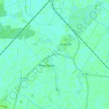
Name: Eutzsch topographic map, elevation, terrain.
Location: Eutzsch, Kemberg, Wittenberg, Sachsen-Anhalt, Deutschland (51.79271 12.59073 51.83748 12.66393)
Average elevation: 220 ft
Minimum elevation: 210 ft
Maximum elevation: 236 ft
Make a donation
Gear up for your next adventure:
As an Amazon Associate, this site earns from qualifying purchases at no extra cost to you.
Other topographic maps
Click on a map to view its topography, its elevation and its terrain.