Geolocate

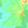
Siddapura topographic map

Click on the map to display elevation.

About this map

Name: Siddapura topographic map, elevation, terrain.

Location: Siddapura, Kundapura, Udupi, Karnataka, 576283, India (13.62718 74.86205 13.70292 74.94314)

Average elevation: 207 ft

Minimum elevation: 62 ft

Maximum elevation: 581 ft

Other topographic maps

Click on a map to view its topography, its elevation and its terrain.
Basruru

India > Karnataka > Kundapura

Average elevation: 36 ft

Tombattu

India > Karnataka > Kundapura

Average elevation: 190 ft

Talluru

India > Karnataka > Kundapura

Average elevation: 36 ft

Trasi

India > Karnataka > Kundapura

Average elevation: 36 ft

Gear up for your next adventure:

🔭Stargazing Telescopes - Perfect for camping in low-light pollution areas shown on maps
🥤Water Filter Bottle - All‑in‑one filter bottle for safe hydration
🛠️Outdoor Gear Repair Kit - Essential tools to fix gear on the trail
📶Vehicle Signal Boosters - Improve reception in rural areas while driving to trailheads
🪶Fire Starter Kit - Reliable fire starter for survival and camping

As an Amazon Associate, this site earns from qualifying purchases at no extra cost to you.