Geolocate

Gordon topographic map

Click on the map to display elevation.

About this map

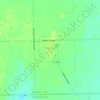
Name: Gordon topographic map, elevation, terrain.

Location: Gordon, Darke County, Ohio, United States (39.92624 -84.51249 39.93383 -84.50568)

Average elevation: 1,040 ft

Minimum elevation: 1,014 ft

Maximum elevation: 1,053 ft

Darke County trails, hiking, mountain biking, running and outdoor activities

Other topographic maps

Click on a map to view its topography, its elevation and its terrain.

Union Corners

United States > Ohio > Darke County

Average elevation: 1,010 ft

Webster

United States > Ohio > Darke County

Average elevation: 991 ft

Horatio

United States > Ohio > Darke County

Average elevation: 1,010 ft

Abbottsville

United States > Ohio > Darke County

Average elevation: 1,050 ft

Hill Grove

United States > Ohio > Darke County

Average elevation: 1,073 ft

Delisle

United States > Ohio > Darke County

Average elevation: 1,053 ft

Gear up for your next adventure:

🎁Geography Themed Gifts - Unique gift ideas for map lovers and geography enthusiasts
🧼Biodegradable Camping Soap - Eco‑friendly soap for outdoor hygiene
🥾Hiking Shoes - Durable and comfortable shoes for trail hiking
🥘Titanium Cookware - Durable, featherlight pots and pans for backpacking
⛑️Personal Locator Beacon - Safety beacon for emergencies

As an Amazon Associate, this site earns from qualifying purchases at no extra cost to you.