Geolocate

Steelhead topographic map

Click on the map to display elevation.

About this map

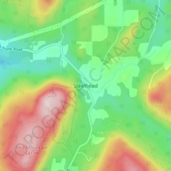
Name: Steelhead topographic map, elevation, terrain.

Location: Steelhead, Mission, Fraser Valley Regional District, British Columbia, V4S 1C4, Canada (49.20041 -122.33618 49.24041 -122.29618)

Average elevation: 961 ft

Minimum elevation: 400 ft

Maximum elevation: 1,847 ft

Other topographic maps

Click on a map to view its topography, its elevation and its terrain.

Gear up for your next adventure:

📻Weather Alert Radios - Stay informed of storm risks while off-the-grid
🎒Day Hiking Backpack - Lightweight backpack perfect for day trips and outdoor adventures
📷Action Camera - Capture your outdoor adventures in HD
🧭Compass with Lanyard - Easy‑carry compass for navigation
🌧️Backpack Rain Cover - Keep gear dry in wet weather

As an Amazon Associate, this site earns from qualifying purchases at no extra cost to you.