
Thank you for supporting this site ❤️
Make a donation
Make a donation
Gear up for your next adventure:
As an Amazon Associate, this site earns from qualifying purchases at no extra cost to you.
Beaverlodge topographic map
Click on the map to display elevation.
Thank you for supporting this site ❤️
Make a donation
Make a donation
Gear up for your next adventure:
As an Amazon Associate, this site earns from qualifying purchases at no extra cost to you.
About this map
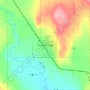
Name: Beaverlodge topographic map, elevation, terrain.
Location: Beaverlodge, Town of Beaverlodge, Alberta, T0H 0C0, Canada (55.17062 -119.46867 55.25062 -119.38867)
Average elevation: 2,411 ft
Minimum elevation: 2,270 ft
Maximum elevation: 2,684 ft
Thank you for supporting this site ❤️
Make a donation
Make a donation
Gear up for your next adventure:
As an Amazon Associate, this site earns from qualifying purchases at no extra cost to you.