Geolocate

Sandy Bottom topographic map

Click on the map to display elevation.

About this map

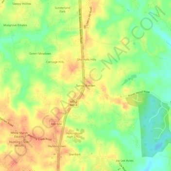
Name: Sandy Bottom topographic map, elevation, terrain.

Location: Sandy Bottom, Calvert County, Maryland, 20639, United States (38.61012 -76.62440 38.65012 -76.58440)

Average elevation: 115 ft

Minimum elevation: 30 ft

Maximum elevation: 180 ft

Other topographic maps

Click on a map to view its topography, its elevation and its terrain.

Lusby

United States > Maryland > Calvert County > Lusby

Average elevation: 62 ft

Huntingtown

United States > Maryland > Calvert County

Average elevation: 105 ft

Solomons

United States > Maryland > Calvert County > Solomons

Average elevation: 13 ft

Owings

United States > Maryland > Calvert County > Owings

Average elevation: 115 ft

Huntingtown

United States > Maryland > Calvert County

Average elevation: 105 ft

Calvert Cliffs

United States > Maryland > Calvert County

Average elevation: 36 ft

Gear up for your next adventure:

🛡️Insect Repellent - Protection against bugs during outdoor activities
🔌Solar Panel Charger - Charge gear sustainably outdoors
🔥Fast-Boil Camping Stoves - Efficient cooking systems for quick trail meals
Backpacking Tents - Weight-optimized shelters for multi-day topographic surveys
🥾Hiking Shoes - Durable and comfortable shoes for trail hiking

As an Amazon Associate, this site earns from qualifying purchases at no extra cost to you.