
飯甑洲 topographic map
Interactive map
Click on the map to display elevation.
About this map
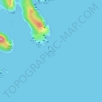
Name: 飯甑洲 topographic map, elevation, terrain.
Location: 飯甑洲, 西貢區, 新界, 香港, 中国 (22.36258 114.39069 22.36480 114.39225)
Average elevation: 23 ft
Minimum elevation: -10 ft
Maximum elevation: 486 ft
Other topographic maps
Click on a map to view its topography, its elevation and its terrain.