
Owyhee River topographic map
Interactive map
Click on the map to display elevation.
About this map
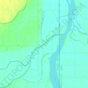
Name: Owyhee River topographic map, elevation, terrain.
Location: Owyhee River, Malheur County, Oregon, United States (43.80684 -117.03830 43.81316 -117.02651)
Average elevation: 2,198 ft
Minimum elevation: 2,178 ft
Maximum elevation: 2,244 ft
Other topographic maps
Click on a map to view its topography, its elevation and its terrain.
Beulah
United States > Oregon > Malheur County
Beulah, Malheur County, Oregon, United States
Average elevation: 3,678 ft
Snake River
United States > Oregon > Malheur County > Nyssa
Snake River, Nyssa, Malheur County, Oregon, United States
Average elevation: 2,195 ft
Jordan Valley
United States > Oregon > Malheur County
Jordan Valley, Malheur County, Oregon, 97910, United States
Average elevation: 4,442 ft
Cairo
United States > Oregon > Malheur County
Cairo, Malheur County, Oregon, United States
Average elevation: 2,195 ft
Vale
United States > Oregon > Malheur County
Vale, Malheur County, Oregon, United States
Average elevation: 2,329 ft
Harper
United States > Oregon > Malheur County
Harper, Malheur County, Oregon, 97906, United States
Average elevation: 2,562 ft
Nyssa
United States > Oregon > Malheur County
Nyssa, Malheur County, Oregon, 97913, United States
Average elevation: 2,188 ft
Rome
United States > Oregon > Malheur County
Rome, Malheur County, Oregon, United States
Average elevation: 3,527 ft
Ontario
United States > Oregon > Malheur County
Ontario, Malheur County, Oregon, 97914, United States
Average elevation: 2,165 ft