Geolocate

Point Lake topographic map

Click on the map to display elevation.

About this map

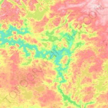
Name: Point Lake topographic map, elevation, terrain.

Location: Point Lake, North Slave Region, Northwest Territories, Canada (64.94085 -114.17782 65.42159 -112.08080)

Average elevation: 1,447 ft

Minimum elevation: 1,217 ft

Maximum elevation: 1,844 ft

Other topographic maps

Click on a map to view its topography, its elevation and its terrain.

Gear up for your next adventure:

🩳Quick‑Dry Hiking Shorts - Comfortable and quick‑dry shorts for summer hiking
🌡️Handheld Weather Meters - Measure wind, temp, and pressure for safe mountain travel
🥤Water Filter Bottle - All‑in‑one filter bottle for safe hydration
👓Polarized Sunglasses - Outdoor sunglasses for glare reduction
🔦LED Headlamp - Bright and durable LED headlamp for night navigation

As an Amazon Associate, this site earns from qualifying purchases at no extra cost to you.