
Ley Leguel topographic map
Interactive map
Click on the map to display elevation.
About this map
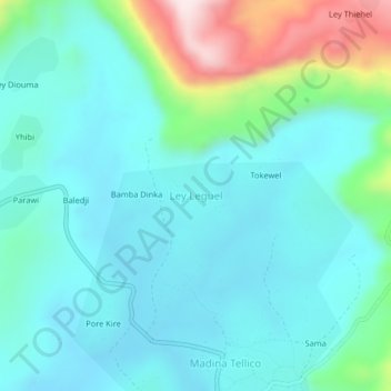
Name: Ley Leguel topographic map, elevation, terrain.
Location: Ley Leguel, Kindia Region, Guinea (11.00929 -13.02686 11.04929 -12.98686)
Average elevation: 2,011 ft
Minimum elevation: 1,686 ft
Maximum elevation: 3,278 ft
Other topographic maps
Click on a map to view its topography, its elevation and its terrain.
Sambayah
Guinea > Kindia Region > Coyah
Sambayah, Coyah, Kindia Region, Guinea
Average elevation: 125 ft