Geolocate

Manambia topographic map

Click on the map to display elevation.

About this map

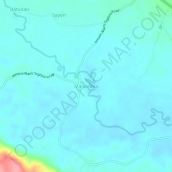
Name: Manambia topographic map, elevation, terrain.

Location: Manambia, Surigao del Sur, Caraga, 8308, Philippines (8.41456 126.12390 8.45456 126.16390)

Average elevation: 82 ft

Minimum elevation: 46 ft

Maximum elevation: 384 ft

Other topographic maps

Click on a map to view its topography, its elevation and its terrain.

Bayabas

Philippines > Surigao del Sur

Average elevation: 115 ft

Hinatuan

Philippines > Surigao del Sur

Average elevation: 98 ft

Vanishing Island

Philippines > Surigao del Sur

Average elevation: 0 ft

Lingig

Philippines > Surigao del Sur

Average elevation: 230 ft

Bislig

Philippines > Surigao del Sur

Average elevation: 233 ft

Carac-an River

Philippines > Surigao del Sur > Cancavan

Average elevation: 75 ft

Lingig

Philippines > Surigao del Sur

Average elevation: 230 ft

Hinatuan

Philippines > Surigao del Sur

Average elevation: 98 ft

Hinatuan

Philippines > Surigao del Sur

Average elevation: 98 ft

Bislig

Philippines > Surigao del Sur

Average elevation: 233 ft

Gear up for your next adventure:

🔥Plasma Lighters - Windproof lighters that work in any weather condition
🪶Thermal Camp Blanket - Extra warmth for cold nights
🧥Men's Rain Shells - Premium waterproof and breathable jackets for mountain weather
🥇GPS Hiking Watch - Multi‑sport GPS watch with navigation and trail tracking
🌐World Map Poster - Decorative world maps with topographic info

As an Amazon Associate, this site earns from qualifying purchases at no extra cost to you.