Geolocate

Baileytown topographic map

Click on the map to display elevation.

About this map

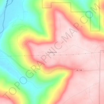
Name: Baileytown topographic map, elevation, terrain.

Location: Baileytown, Jackson County, Alabama, United States (34.83897 -86.18943 34.87897 -86.14943)

Average elevation: 1,289 ft

Minimum elevation: 633 ft

Maximum elevation: 1,745 ft

Jackson County trails, hiking, mountain biking, running and outdoor activities

Other topographic maps

Click on a map to view its topography, its elevation and its terrain.

Skyline

United States > Alabama > Jackson County

Average elevation: 1,276 ft

Langston

United States > Alabama > Jackson County

Average elevation: 797 ft

Paint Rock

United States > Alabama > Jackson County

Average elevation: 810 ft

Pleasant Groves

United States > Alabama > Jackson County

Average elevation: 1,086 ft

Hytop

United States > Alabama > Jackson County

Average elevation: 1,355 ft

Dutton

United States > Alabama > Jackson County

Average elevation: 1,345 ft

Scottsboro

United States > Alabama > Jackson County

Average elevation: 771 ft

Stevenson

United States > Alabama > Jackson County

Average elevation: 810 ft

Paint Rock

United States > Alabama > Jackson County

Average elevation: 817 ft

Pisgah

United States > Alabama > Jackson County > Pisgah

Average elevation: 1,375 ft

Gear up for your next adventure:

🧣Merino Neck Gaiters - Multi-functional headwear for wind and sun protection
📚Navigation Handbooks - Master the art of reading topographic maps and using a compass
🎒Waterproof Dry Bags - Keep your electronics and maps dry inside your pack
🏔️Mountain Trail Maps - High‑detail maps for popular peaks
🎒Trekking Poles - Sturdy poles for balance and stability on rough terrain

As an Amazon Associate, this site earns from qualifying purchases at no extra cost to you.