Geolocate

Streeter topographic map

Click on the map to display elevation.

About this map

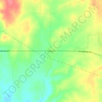
Name: Streeter topographic map, elevation, terrain.

Location: Streeter, Mason County, Texas, United States (30.74490 -99.39645 30.78490 -99.35645)

Average elevation: 1,709 ft

Minimum elevation: 1,601 ft

Maximum elevation: 1,834 ft

Mason County trails, hiking, mountain biking, running and outdoor activities

Other topographic maps

Click on a map to view its topography, its elevation and its terrain.

Mason

United States > Texas > Mason County

Average elevation: 1,588 ft

Gear up for your next adventure:

🚗GPS Dash Cams - Record your scenic drives through mountain passes and canyons
🛶Inflatable Kayak - Portable kayak for rivers, lakes, and expeditions
🗃️Trail First Aid Kit - Essential kit for outdoor injuries and emergencies
🪶Trail Camera - Capture wildlife on your hikes
🪶LED Camping Lantern - Bright lantern for camp lighting

As an Amazon Associate, this site earns from qualifying purchases at no extra cost to you.