
碧土乡 topographic map
Interactive map
Click on the map to display elevation.
About this map
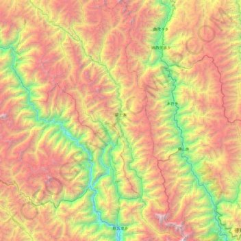
Name: 碧土乡 topographic map, elevation, terrain.
Location: 碧土乡, 左贡县, 昌都市, 西藏自治区, 中国 (28.43845 98.25952 29.17767 98.69170)
Average elevation: 12,927 ft
Minimum elevation: 6,001 ft
Maximum elevation: 21,969 ft
Other topographic maps
Click on a map to view its topography, its elevation and its terrain.