Geolocate

Draycot Foliat topographic map

Click on the map to display elevation.

About this map

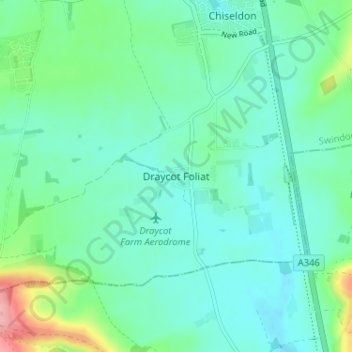
Name: Draycot Foliat topographic map, elevation, terrain.

Location: Draycot Foliat, Swindon, England, SN4 0HX, United Kingdom (51.47809 -1.76000 51.51809 -1.72000)

Average elevation: 564 ft

Minimum elevation: 479 ft

Maximum elevation: 873 ft

Other topographic maps

Click on a map to view its topography, its elevation and its terrain.

Highworth

United Kingdom > England > Swindon

Average elevation: 318 ft

Shaftsbury Lakes

United Kingdom > England > Swindon

Average elevation: 354 ft

Hannington

United Kingdom > England > Swindon

Average elevation: 289 ft

Blunsdon

United Kingdom > England > Swindon > Broad Blunsdon

Average elevation: 361 ft

Stratton St. Margaret

United Kingdom > England > Swindon > Swindon

Average elevation: 354 ft

Wroughton

United Kingdom > England > Swindon

Average elevation: 502 ft

South Marston

United Kingdom > England > Swindon

Average elevation: 331 ft

Wanborough

United Kingdom > England > Swindon

Average elevation: 456 ft

Chiseldon

United Kingdom > England > Swindon

Average elevation: 561 ft

Liddington

United Kingdom > England > Swindon > Liddington

Average elevation: 564 ft

Inglesham

United Kingdom > England > Swindon

Average elevation: 253 ft

Haydon Wick

United Kingdom > England > Swindon

Average elevation: 341 ft

Wroughton

United Kingdom > England > Swindon

Average elevation: 502 ft

Wroughton

United Kingdom > England > Swindon

Average elevation: 502 ft

Gear up for your next adventure:

🪶Camping Sleeping Pad - Comfortable sleeping pad for backpacking
🪶Wildlife Field Guides - Learn animal tracking and species ID
⛑️Personal Locator Beacon - Safety beacon for emergencies
☀️Outdoor Sunscreen - High protection sunscreen for outdoor activities
🛡️Bear Spray Outdoor - Protection in bear country hikes

As an Amazon Associate, this site earns from qualifying purchases at no extra cost to you.