
Libertyville topographic map
Interactive map
Click on the map to display elevation.
About this map
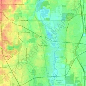
Name: Libertyville topographic map, elevation, terrain.
Location: Libertyville, Lake County, Illinois, 60048, United States (42.24557 -88.02262 42.32464 -87.92485)
Average elevation: 705 ft
Minimum elevation: 633 ft
Maximum elevation: 814 ft
Lake County trails, hiking, mountain biking, running and outdoor activities
Other topographic maps
Click on a map to view its topography, its elevation and its terrain.
Lake Naomi
United States > Illinois > Lake County > Hawthorn Woods > White Birch Lakes
Average elevation: 856 ft
Bishops Ridge
United States > Illinois > Lake County > Kildeer > Bishops Ridge
Average elevation: 830 ft