
Contepec topographic map
Interactive map
Click on the map to display elevation.
About this map
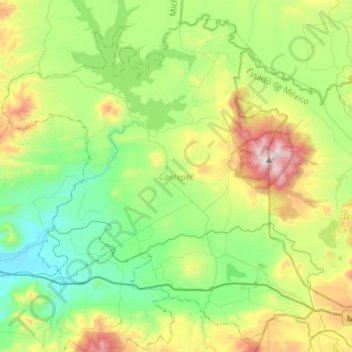
Name: Contepec topographic map, elevation, terrain.
Location: Contepec, Michoacán, Mexico (19.83879 -100.34506 20.08300 -100.06303)
Average elevation: 7,864 ft
Minimum elevation: 6,634 ft
Maximum elevation: 10,610 ft
Other topographic maps
Click on a map to view its topography, its elevation and its terrain.
Zamora
The city of Zamora is an important economic center in the state and the most significant population center between the cities of Morelia and Guadalajara. The city is located on the Tarascan Plateau in the northwestern part of the state, at an elevation of 1,567 m (5,141 ft) above sea level. Zamora is…
Average elevation: 5,899 ft
Morelia
Under the Köppen climate classification, Morelia has a subtropical highland climate (abbreviated Cwb on climate maps), with warm-to-hot days and cool nights year round due to its high elevation. Most precipitation falls during the summer monsoon season from June to September. Average monthly temperatures are…
Average elevation: 6,795 ft