
Port Ludlow topographic map
Interactive map
Click on the map to display elevation.
About this map
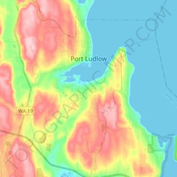
Name: Port Ludlow topographic map, elevation, terrain.
Average elevation: 210 ft
Minimum elevation: -3 ft
Maximum elevation: 554 ft
Jefferson County trails, hiking, mountain biking, running and outdoor activities
Other topographic maps
Click on a map to view its topography, its elevation and its terrain.
Port Townsend
United States > Washington > Jefferson County > Port Townsend > Port Townsend
Average elevation: 59 ft