
Pingtung County topographic map
Interactive map
Click on the map to display elevation.
About this map
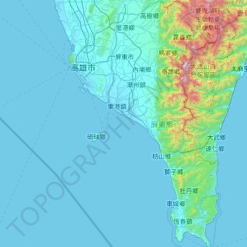
Name: Pingtung County topographic map, elevation, terrain.
Location: Pingtung County, Taiwan (21.89686 120.35290 22.88515 120.90419)
Average elevation: 676 ft
Minimum elevation: -10 ft
Maximum elevation: 9,892 ft
Other topographic maps
Click on a map to view its topography, its elevation and its terrain.
Yushan
Taiwan > Nantou County > Xinyi Township
Yu Shan or Yushan, also known as Mount Jade, Jade Mountain, Tongku Saveq or Mount Niitaka during Japanese rule, is the highest mountain in Taiwan at 3,952 m (12,966 ft) above sea level, giving Taiwan the 4th-highest maximum elevation of any island in the world. It is the highest point in the western Pacific…
Average elevation: 11,191 ft
Songbailun
Taiwan > Taiwan Province > Nantou County > Yuchi Township > Songbailun
Average elevation: 2,533 ft