
Sumatra topographic map
Interactive map
Click on the map to display elevation.
About this map
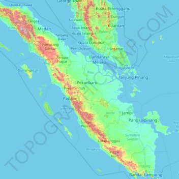
Name: Sumatra topographic map, elevation, terrain.
Location: Sumatra, Indonesia (-5.94309 95.19356 5.65659 106.09665)
Average elevation: 305 ft
Minimum elevation: -10 ft
Maximum elevation: 11,243 ft
Other topographic maps
Click on a map to view its topography, its elevation and its terrain.