
Newburgh topographic map
Interactive map
Click on the map to display elevation.
About this map
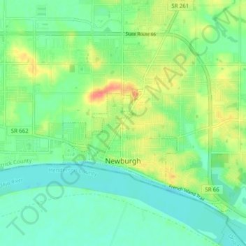
Name: Newburgh topographic map, elevation, terrain.
Location: Newburgh, Warrick County, Indiana, United States (37.93939 -87.42346 37.97032 -87.34734)
Average elevation: 404 ft
Minimum elevation: 341 ft
Maximum elevation: 525 ft
Warrick County trails, hiking, mountain biking, running and outdoor activities
Other topographic maps
Click on a map to view its topography, its elevation and its terrain.