
Fall River topographic map
Interactive map
Click on the map to display elevation.
About this map
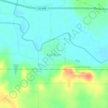
Name: Fall River topographic map, elevation, terrain.
Location: Fall River, Greenwood County, Kansas, 67047, United States (37.60418 -96.03323 37.61180 -96.02461)
Average elevation: 955 ft
Minimum elevation: 902 ft
Maximum elevation: 1,076 ft
Greenwood County trails, hiking, mountain biking, running and outdoor activities
Other topographic maps
Click on a map to view its topography, its elevation and its terrain.