
Finland topographic map
Interactive map
Click on the map to display elevation.
About this map
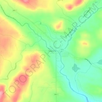
Name: Finland topographic map, elevation, terrain.
Location: Finland, Lake County, Minnesota, 55603, United States (47.39464 -91.26905 47.43464 -91.22905)
Average elevation: 1,394 ft
Minimum elevation: 1,220 ft
Maximum elevation: 1,617 ft
Lake County trails, hiking, mountain biking, running and outdoor activities
Other topographic maps
Click on a map to view its topography, its elevation and its terrain.
Boundary Waters Canoe Area Wilderness
United States > Minnesota > Lake County
Average elevation: 1,388 ft