Geolocate

Skidaway Island topographic map

Interactive map

Click on the map to display elevation.

About this map

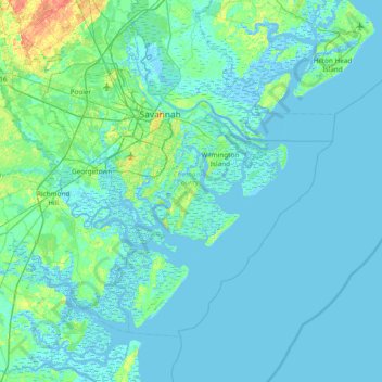
Name: Skidaway Island topographic map, elevation, terrain.

Location: Skidaway Island, Chatham County, Georgia, 31411, United States (31.62883 -81.35094 32.26883 -80.71094)

Average elevation: 10 ft

Minimum elevation: -16 ft

Maximum elevation: 92 ft

Chatham County trails, hiking, mountain biking, running and outdoor activities

Other topographic maps

Click on a map to view its topography, its elevation and its terrain.

Forsyth Park

United States > Georgia > Chatham County > Savannah

Average elevation: 39 ft

Garden City

United States > Georgia > Chatham County

Average elevation: 23 ft

Vernonburg

United States > Georgia > Chatham County

Average elevation: 16 ft

Bloomingdale

United States > Georgia > Chatham County

Average elevation: 26 ft

Fort Pulaski

United States > Georgia > Chatham County

Average elevation: 3 ft

Daffin Park

United States > Georgia > Chatham County > Savannah

Average elevation: 30 ft

Thunderbolt

United States > Georgia > Chatham County

Average elevation: 16 ft