
Port Richey topographic map
Interactive map
Click on the map to display elevation.
About this map
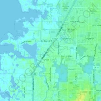
Name: Port Richey topographic map, elevation, terrain.
Location: Port Richey, Pasco County, Florida, United States (28.26325 -82.75125 28.28783 -82.70317)
Average elevation: 13 ft
Minimum elevation: -7 ft
Maximum elevation: 49 ft
Pasco County trails, hiking, mountain biking, running and outdoor activities
Other topographic maps
Click on a map to view its topography, its elevation and its terrain.
Wesley Chapel
United States > Florida > Pasco County
According to the United States Census Bureau, the CDP has a total area of 6.1 square miles (16 km2), of which 6.1 square miles (16 km2) is land and 0.04 square miles (0.10 km2) (0.49%) is water. The elevation is about 100 feet (30 m), combined with an inland location, creates more temperature variation in the…
Average elevation: 62 ft