
Totowa topographic map
Interactive map
Click on the map to display elevation.
About this map
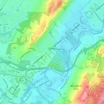
Name: Totowa topographic map, elevation, terrain.
Location: Totowa, Passaic County, New Jersey, 07512, United States (40.88257 -74.25043 40.92475 -74.19592)
Average elevation: 226 ft
Minimum elevation: 115 ft
Maximum elevation: 538 ft
Passaic County trails, hiking, mountain biking, running and outdoor activities
Other topographic maps
Click on a map to view its topography, its elevation and its terrain.