
Kymenlaakso topographic map
Interactive map
Click on the map to display elevation.
About this map
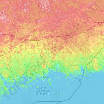
Name: Kymenlaakso topographic map, elevation, terrain.
Location: Kymenlaakso, Southern Finland, Mainland Finland, Finland (60.17126 26.23542 61.29259 27.99129)
Average elevation: 154 ft
Minimum elevation: -7 ft
Maximum elevation: 538 ft
Other topographic maps
Click on a map to view its topography, its elevation and its terrain.
Kilpisjärvi
Although Kilpisjärvi is one of the largest villages in Enontekiö, it is still quite small. In 2000 its population was recorded as 114. Like most Sami villages, Kilpisjärvi is built mainly around one major road, Käsivarrentie, or the "Arm Road" and Neljäntuulentie, or the "Four Winds' Road" — also known…
Average elevation: 1,890 ft