
Leesburg topographic map
Interactive map
Click on the map to display elevation.
About this map
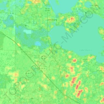
Name: Leesburg topographic map, elevation, terrain.
Location: Leesburg, Lake County, Florida, 34738, United States (28.65853 -81.95462 28.84616 -81.77183)
Average elevation: 85 ft
Minimum elevation: 36 ft
Maximum elevation: 203 ft
Lake County trails, hiking, mountain biking, running and outdoor activities
Other topographic maps
Click on a map to view its topography, its elevation and its terrain.