
South Kalimantan topographic map
Interactive map
Click on the map to display elevation.
About this map
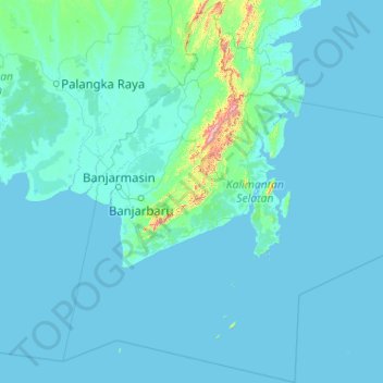
Name: South Kalimantan topographic map, elevation, terrain.
Location: South Kalimantan, Kalimantan, Indonesia (-5.41389 113.99113 -1.31258 117.90095)
Average elevation: 98 ft
Minimum elevation: -3 ft
Maximum elevation: 5,463 ft
Other topographic maps
Click on a map to view its topography, its elevation and its terrain.