
Hixon topographic map
Interactive map
Click on the map to display elevation.
About this map
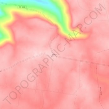
Name: Hixon topographic map, elevation, terrain.
Location: Hixon, Grundy County, Tennessee, United States (35.42646 -85.82942 35.46646 -85.78942)
Average elevation: 1,916 ft
Minimum elevation: 1,260 ft
Maximum elevation: 2,064 ft
Grundy County trails, hiking, mountain biking, running and outdoor activities
Other topographic maps
Click on a map to view its topography, its elevation and its terrain.
Monteagle
United States > Tennessee > Grundy County
The town straddles a narrow stretch of the Cumberland Plateau known colloquially as "Monteagle Mountain". This stretch of the plateau is approximately 2 miles (3 km) wide, with steep drop-offs to the northwest and southeast. Monteagle lies at an elevation of just under 2,000 feet (610 m) above sea level. By…
Average elevation: 1,598 ft
South Cumberland Recreation Area
United States > Tennessee > Grundy County > Beersheba Springs
Average elevation: 1,749 ft
Altamont
United States > Tennessee > Grundy County
Altamont was established in 1848 as a county seat for Grundy County, which had been created in 1844. General Adrian Northcutt, a prominent local farmer and military officer, was the prime advocate for the site's selection. The town's name comes from combining alto (meaning "altitude") and mont (meaning…
Average elevation: 1,854 ft