
Belcher Island topographic map
Interactive map
Click on the map to display elevation.
About this map
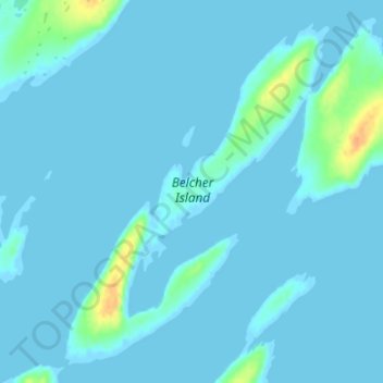
Name: Belcher Island topographic map, elevation, terrain.
Location: Belcher Island, Nunavut, Canada (56.10162 -78.81851 56.13306 -78.75643)
Average elevation: 10 ft
Minimum elevation: -10 ft
Maximum elevation: 105 ft
Other topographic maps
Click on a map to view its topography, its elevation and its terrain.
Thor Peak
Canada > Nunavut > Qikiqtaaluk Region
Mount Thor, officially gazetted as Thor Peak (Inuktitut: ᙯᕐᓱᐊᓗᒃ Qaisualuk "huge bedrock" or Inuktitut: ᑭᒍᑎᙳᐊᖅ Kigutinnguaq "resembles a tooth"), is a mountain with an elevation of 1,675 metres (5,495 ft) located in Auyuittuq National Park, on Baffin Island, Nunavut, Canada. The mountain…
Average elevation: 2,264 ft