
Bruinisse topographic map
Interactive map
Click on the map to display elevation.
About this map
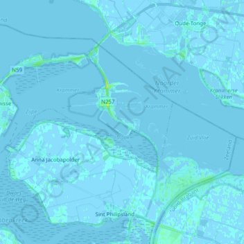
Name: Bruinisse topographic map, elevation, terrain.
Location: Bruinisse, Schouwen-Duiveland, Zeeland, Netherlands (51.61270 4.04941 51.69278 4.20270)
Average elevation: 0 ft
Minimum elevation: -13 ft
Maximum elevation: 43 ft
Other topographic maps
Click on a map to view its topography, its elevation and its terrain.
Oost-Souburg
Netherlands > Zeeland > Vlissingen
Oost-Souburg, Vlissingen, Zeeland, Netherlands
Average elevation: 0 ft
Kop van Schouwen
Netherlands > Zeeland > Burgh-Haamstede
Kop van Schouwen, Burgh-Haamstede, Schouwen-Duiveland, Zeeland, Netherlands
Average elevation: 7 ft
Middelburg
Netherlands > Zeeland > Middelburg
Middelburg, Zeeland, Netherlands, 4331BH, Netherlands
Average elevation: 0 ft
Renesse
Netherlands > Zeeland > Renesse
Renesse, Schouwen-Duiveland, Zeeland, Netherlands
Average elevation: 3 ft
419
Netherlands > Zeeland > Noord-Beveland
419, Noord-Beveland, Zeeland, Netherlands
Average elevation: 0 ft
234
Netherlands > Zeeland > Noord-Beveland
234, Noord-Beveland, Zeeland, Netherlands
Average elevation: 0 ft
357
Netherlands > Zeeland > Noord-Beveland
357, Noord-Beveland, Zeeland, Netherlands
Average elevation: 0 ft
Neeltje Jans
Netherlands > Zeeland > Veere
Neeltje Jans, Veere, Zeeland, Netherlands, 4354RA, Netherlands
Average elevation: 3 ft