
Kamihei topographic map
Interactive map
Click on the map to display elevation.
About this map
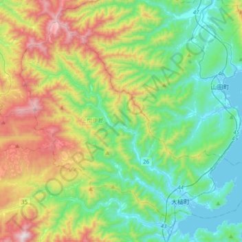
Name: Kamihei topographic map, elevation, terrain.
Location: Kamihei, Iwate Prefecture, Tohoku, Japan (39.33994 141.70215 39.52937 142.00048)
Average elevation: 1,280 ft
Minimum elevation: -3 ft
Maximum elevation: 4,190 ft
Other topographic maps
Click on a map to view its topography, its elevation and its terrain.
Lake Towada
Lake Towada, Towada Prince Hotel, Kosaka, Kazuno, Akita Prefecture, Tohoku, 0185501, Japan
Average elevation: 1,608 ft
Mt. Gassan
Mt. Gassan, Tsuruoka, Yamagata Prefecture, Tohoku, Japan
Average elevation: 5,479 ft