
Thank you for supporting this site ❤️
Make a donation
Make a donation
Gear up for your next adventure:
As an Amazon Associate, this site earns from qualifying purchases at no extra cost to you.
Yên Minh District topographic map
Click on the map to display elevation.
Gear up for your next adventure:
As an Amazon Associate, this site earns from qualifying purchases at no extra cost to you.
About this map
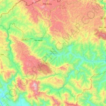
Name: Yên Minh District topographic map, elevation, terrain.
Location: Yên Minh District, Hà Giang Province, 20318, Vietnam (22.87499 104.95822 23.26692 105.38459)
Average elevation: 3,081 ft
Minimum elevation: 374 ft
Maximum elevation: 7,316 ft
Thank you for supporting this site ❤️
Make a donation
Make a donation
Gear up for your next adventure:
As an Amazon Associate, this site earns from qualifying purchases at no extra cost to you.
Other topographic maps
Click on a map to view its topography, its elevation and its terrain.