
Hollister topographic map
Interactive map
Click on the map to display elevation.
About this map
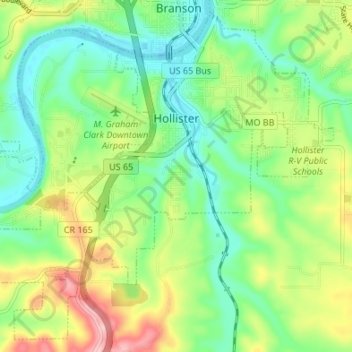
Name: Hollister topographic map, elevation, terrain.
Location: Hollister, Taney County, Missouri, 65672, United States (36.59016 -93.25533 36.64030 -93.18790)
Average elevation: 889 ft
Minimum elevation: 689 ft
Maximum elevation: 1,247 ft
Taney County trails, hiking, mountain biking, running and outdoor activities
Other topographic maps
Click on a map to view its topography, its elevation and its terrain.