
Cleveland topographic map
Interactive map
Click on the map to display elevation.
About this map
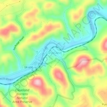
Name: Cleveland topographic map, elevation, terrain.
Location: Cleveland, Russell County, Virginia, United States (36.93979 -82.15769 36.94716 -82.14849)
Average elevation: 1,788 ft
Minimum elevation: 1,490 ft
Maximum elevation: 2,195 ft
Russell County trails, hiking, mountain biking, running and outdoor activities
Other topographic maps
Click on a map to view its topography, its elevation and its terrain.