
Vallecito topographic map
Interactive map
Click on the map to display elevation.
About this map
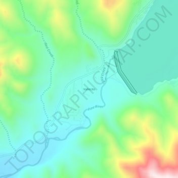
Name: Vallecito topographic map, elevation, terrain.
Location: Vallecito, La Plata County, Colorado, United States (37.35528 -107.60395 37.39528 -107.56395)
Average elevation: 7,917 ft
Minimum elevation: 7,398 ft
Maximum elevation: 9,350 ft
La Plata County trails, hiking, mountain biking, running and outdoor activities
Other topographic maps
Click on a map to view its topography, its elevation and its terrain.