
Mehoopany topographic map
Interactive map
Click on the map to display elevation.
About this map
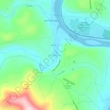
Name: Mehoopany topographic map, elevation, terrain.
Location: Mehoopany, Wyoming County, Pennsylvania, United States (41.54341 -76.08048 41.58341 -76.04048)
Average elevation: 922 ft
Minimum elevation: 597 ft
Maximum elevation: 1,867 ft
Wyoming County trails, hiking, mountain biking, running and outdoor activities
Other topographic maps
Click on a map to view its topography, its elevation and its terrain.