
Richmond topographic map
Interactive map
Click on the map to display elevation.
About this map
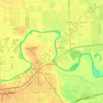
Name: Richmond topographic map, elevation, terrain.
Location: Richmond, Fort Bend County, Texas, 44769, United States (29.55484 -95.79148 29.63068 -95.69134)
Average elevation: 89 ft
Minimum elevation: 23 ft
Maximum elevation: 112 ft
Fort Bend County trails, hiking, mountain biking, running and outdoor activities
Other topographic maps
Click on a map to view its topography, its elevation and its terrain.
Brazos Bend State Park
United States > Texas > Fort Bend County > Alvin
Brazos Bend State Park occupies land bordering the Brazos River and includes within its boundaries low-lying areas left over from the River's previous meanderings. Pre-Columbian inhabitants included a series of Native American groups, most notably the Karankawa. The land passed through a variety of landowners'…
Average elevation: 56 ft
Sienna (Brazos River) Park
United States > Texas > Fort Bend County > Missouri City
Average elevation: 66 ft