
Wanaque topographic map
Interactive map
Click on the map to display elevation.
About this map
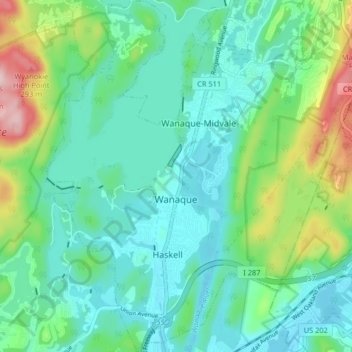
Name: Wanaque topographic map, elevation, terrain.
Location: Wanaque, Passaic County, New Jersey, United States (41.01140 -74.32437 41.07293 -74.25060)
Average elevation: 410 ft
Minimum elevation: 197 ft
Maximum elevation: 1,076 ft
Passaic County trails, hiking, mountain biking, running and outdoor activities
Other topographic maps
Click on a map to view its topography, its elevation and its terrain.